

The importance of habitat data

Ailidh is in the Monitoring Research team and works on a wide range of projects related to understanding change in populations of birds and other taxa, and the effectiveness of protected areas. Her work encompasses analyses of abundance and distribution data from the BTO's major volunteer recording schemes (e.g. BBS and BirdTrack) and comprehensive literature searches on particular issues such as the impact of invertebrate declines, the importance of habitat recording and non-native species.
Related topics
Related Publications
Why do we need to record habitat information? BTO Research Ecologist Ailidh Barnes explains why these important, yet often disregarded data, are vital for understanding how birds use their environment.
My PhD experience
As an ecologist, it is not only the geographic location of the birds, or any organism, that is important, but also the type of area where they reside, the habitat in which they choose to breed, forage or roost. Habitat therefore plays a critical role in determining how many birds occur, of which kind, and how successfully they breed and survive.
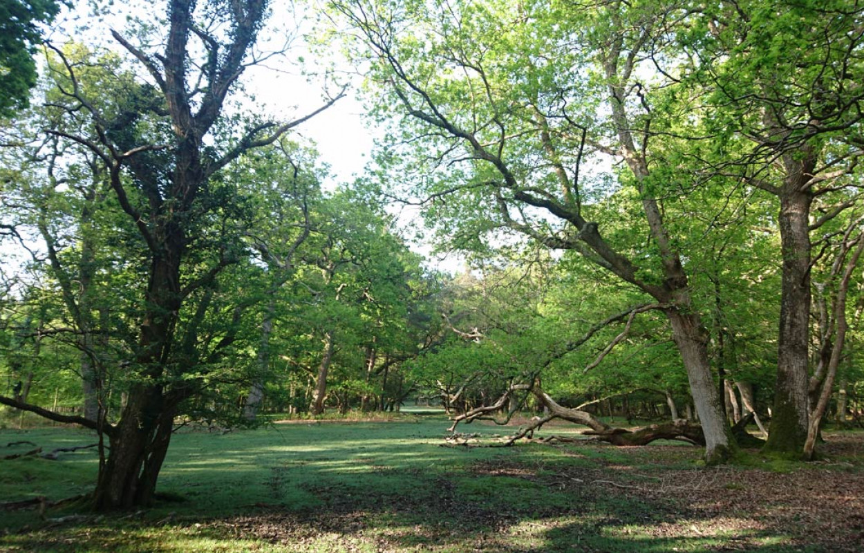
For my PhD research at Bournemouth University I surveyed the breeding birds in different habitats in two contrasting landscapes in southern England. The New Forest National Park landscape is mixed heather and gorse heathland and woodland, with both ancient broadleaved (deciduous) woodlands of oak and beech, and patches of conifer plantations often of ‘exotic’, non-native species. The Cambridgeshire landscape centered on Monks Wood National Nature Reserve, on the other hand, is an agricultural area of mainly large arable fields with small, scattered pockets of what was once an ancient broadleaved woodland that stretched across this landscape.
As someone more interested in recording birds, I had to quickly learn on-the-job the various tree and shrub species in these areas, some of which were new to me moving from central Scotland to southern England (such as the Wild Service tree), and the exotic species planted in the New Forest National Park, which included different bewildering species of coastal redwood, normally found in America. The percentage cover of each species formed part of the habitat data I needed for my analysis of bird occurrence.

To add to the species data I collected in the field I also used remotely-sensed aerial data in the form of Light Detecting and Ranging (LiDAR) which provide a measure of vegetation structure (e.g. height and density) to compare across the habitat types and landscape. LiDAR uses a laser pulse to create a light beam which bounces off of objects on the ground before returning to the sensor. The system can then use the time it takes for each pulse to return to create a detailed 3D point cloud of the objects in terms of height, width, and depth (for more detailed information see Vierling et al. 2008). This means it can, for example, reveal the detailed structure of a tree canopy, openness of the habitat, or slope/undulation of the terrain.

This habitat information was essential to my research as, for example, two broadleaved Oak and Beech woodlands may appear the same, but subtle differences in structure or composition of the trees (e.g. in the amount of Beech, Oak or even Field Maple or conifers) and undergrowth species (e.g. whether Holly, bramble, bracken etc. is present) can dramatically alter the residing bird species community (Barnes 2020). Numbers of Firecrest, for example, in the New Forest are influenced by the presence or absence of holly in broadleaved woodlands (Batten 1973; Clements et al. 2017).
This habitat information allowed me to associate measurements of the bird community: species richness, diversity, the number of birds with declining populations and therefore of conservation priority, rarity (low population size), and community composition to the habitats. These relationships were vital to underpinning and understanding the important, and also detrimental, habitats in these two landscapes for birds. For example, diversity was higher in the scrubland habitats in the New Forest and in woodland edges in Cambridgeshire; whereas rare birds were in the heathland and exotic conifers in the New Forest and there were more declining bird species associated with hedges in Cambridgeshire. Therefore, New Forest National Park supported a higher number of rare bird species, but agricultural Cambridgeshire supported more declining bird species, even though this is most likely a result of agricultural intensification seen across the UK. Both pine plantations in the New Forest and fields adjacent to woodlands in Cambridgeshire were overall poor bird habitats, demonstrating that each landscape had both ‘good’ and ‘bad’ bird habitats, which also varied in species community, and the surveyed habitat data provided the detail required to explain these differences.
Habitat information is used all the time
Habitat information can also be used to guide and inform management strategies, not only in the areas I studied for my PhD, but also nationally through volunteer schemes, such as the Breeding Bird Survey (BBS). National volunteer schemes, including BBS, Wetland Bird Survey (WeBS), and UK Butterfly Monitoring Scheme (UKBMS), require habitat information to be collected as part of the survey. However, uptake is often poor, in part due to the difficulties in recording habitat, but also because people don’t see the importance of the habitat data when their focus is on a particular species or taxon (e.g. birds or butterflies).
Well I’m here to tell you that this is not the case! In fact, habitat data are vital, and used every year to produce the Bird Indicators which are used by government to track how well bird populations are doing and which require knowing whether the bird was on farmland, woodland, wetland or urban habitats, and the Bird Atlas, amongst others.

Habitat information is also used to identify autecology – the ecology of particular species. We know that the Willow Warbler, and the globally threatened Turtle Dove, for instance, prefer scrubby habitats with younger trees of birch and willow (Dunn & Morris 2012; Barnes 2020). This suggests that the loss of these habitats in the UK could be driving the declines in these species, amongst other factors (Morrison 2010). However, things aren’t always that simple, as other things may be contributing to the declines, such as climate change (Martay et al. in press) and as these species also migrate, factors in their wintering grounds may also need to be assessed (Morrison et al. 2013). More optimistically, some bird populations, such as the Little Egret, are increasing driven by the availability of suitable habitat in the UK coupled with range expansion into new areas. Without habitat data, ornithologists and our very own scientists at the BTO, couldn’t do most of our analysis or publish these results.
Advances in technology mean there is an ever-increasing number of ways that the environment (including some, but not all, aspects of habitat), can be measured remotely from above, for example satellite imagery (as used by Google Maps for example) or planes fitted with LiDAR equipment. However, much of this “Earth Observation” data still requires validation from this vital on-the-ground habitat information. Earth Observation data provide a larger scale picture of the landscape and this would improve our research and fundamental understanding of species, but at the moment these data still need to have information collected from the ground.
A wilder UK landscape
If we have learned anything from the recent pandemic, it is that nature and natural spaces are good for our mental health and wellbeing. However, these “natural” spaces are probably not as natural as you think. Agriculture is a massive part of our landscape to provide us with food and resources, but making the agricultural landscape more wildlife and environmentally friendly would benefit us in more ways than one. Rust et al. (2021) completed a study into how people would like our farmland to look and found support for more trees, renewable energy sources and increased agricultural and biological diversity. The UK Centre for Ecology and Hydrology has modelled these changes, both positive and negative, across the UK to predict what our landscape could look like, and what wildlife it could or couldn’t support (Redhead et al. 2021). You can explore these changes for yourself in a tool developed jointly with the BTO for the ASSET project. Needless to say, we need to know what habitats are available and present currently and which ones are doing well for our wildlife in order to plan and manage the future landscape.
So next time you are surveying your BBS square and wonder “Why do I need to collect habitat data?”, just remember that this information is vital for understanding how to manage bird populations and it is essential that our biodiversity has a place to live!
Other references
Barnes, A., 2020. Modelling mitigation of bird population declines in the UK through landscape-scale environmental management (Doctoral dissertation, Bournemouth University).
Batten, L. A., 1973. The colonisation of England by the Firecrest. British Birds, 66 (1953), 159–166.
Clements, R., Ward, M., and Wynn, R., 2017. Firecrests in Britain. British Birds, 110, 375–387.
Dunn, J. C. and Morris, A. J., 2012. Which features of UK farmland are important in retaining territories of the rapidly declining Turtle Dove Streptopelia turtur ? Bird Study, 59 (4), 394–402.
Redhead (2021) ASSET Scenario Exploration Tool. Accessed June 2021: https://assist.ceh.ac.uk/asset-v2
Vierling, K. T., Vierling, L. A., Gould, W. A., Martinuzzi, S., and Clawges, R. M., 2008. Lidar: Shedding new light on habitat characterization and modeling. Frontiers in Ecology and the Environment, 6 (2), 90–98.


Share this page